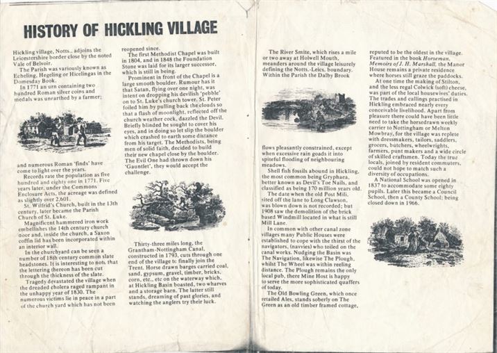
Take a brief photographic tour of Hickling here:
Click on the Gallery, below, to open up full-size images:
")
The newly restored Lengthman’s Hut and a beautiful Autumn morning (14th Sept 2020)
The newly restored Lengthman’s Hut and a beautiful Autumn morning (14th Sept 2020)
")
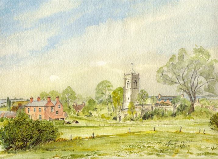
Main St. – the church and Glebe Cottage (2019)
Main St. – the church and Glebe Cottage (2019)
")
Main St. from Bridegate junction towards the Church (2019)
Main St. from Bridegate junction towards the Church (2019)
")
Millennium Sign, Bridegate Lane junction (2019)
Millennium Sign, Bridegate Lane junction (2019)
")
Bridegate Lane from the village junction (2019)
Bridegate Lane from the village junction (2019)
")
Old village sign, Clawson Lane (2019)
Old village sign, Clawson Lane (2019)
")
Old village sign, Clawson Lane (2019)
Old village sign, Clawson Lane (2019)
")
The cemetery, Clawson Lane (2019)
The cemetery, Clawson Lane (2019)
")
The Cemetery, Clawson Lane (2019)
The Cemetery, Clawson Lane (2019)
")
Entrance to the village, Clawson Lane (2019)
Entrance to the village, Clawson Lane (2019)
")
Village Hall (2019)
Village Hall (2019)
")
Village Hall (2019)
Village Hall (2019)
")
Village Hall (2019)
Village Hall (2019)
")
Entrance to the village from the south (2019)
Entrance to the village from the south (2019)
")
Top of Green Lane towards Belvoir Castle (2019)
Top of Green Lane towards Belvoir Castle (2019)
")
Bridegate Lane down the hill towards Hickling (2019)
Bridegate Lane down the hill towards Hickling (2019)
")
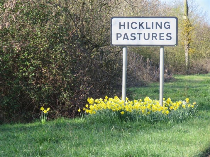
Village sign for Hickling Pastures on Bridegate Lane (2019)
Village sign for Hickling Pastures on Bridegate Lane (2019)
")
The Trig Point from Bridegate Lane (2019)
The Trig Point from Bridegate Lane (2019)
")
The Trig Point from Bridegate Lane (2019)
The Trig Point from Bridegate Lane (2019)
")
Site of the old Washpit, Bridegate Lane (2019)
Site of the old Washpit, Bridegate Lane (2019)
 2019")
The Old Chapel (looking South) 2019
The Old Chapel (looking South) 2019
 2019")
Entrance to the village from Kinoulton direction (north) 2019
Entrance to the village from Kinoulton direction (north) 2019
")
Main St. north towards the Church (2019)
Main St. north towards the Church (2019)

St. Luke’s from the canal
St. Luke’s from the canal

St. Luke’s, Hickling.
St. Luke’s, Hickling.

Swan on the Grantham Canal.
Swan on the Grantham Canal.

St. Luke’s from the canal towpath.
St. Luke’s from the canal towpath.

The Plough Inn, Hickling.
The Plough Inn, Hickling.

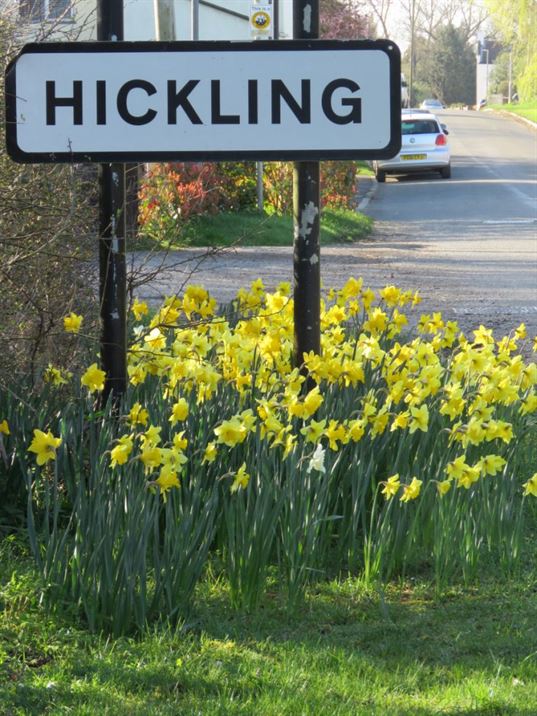
Millennium Village Sign
Millennium Village Sign

Millennium Village Sign
Millennium Village Sign

Signposts on the Bridegate Lane junction.
Signposts on the Bridegate Lane junction.

Hickling Canal Basin
Hickling Canal Basin

Sledging down the Hickling Standards
Sledging down the Hickling Standards

Grantham Canal next to the first swing bridge looking south
Grantham Canal next to the first swing bridge looking south

Swan
Swan

Hickling Standard in the snow
Hickling Standard in the snow

Grantham Canal next to Bridge View
Grantham Canal next to Bridge View

St. Luke’s Parish Church
St. Luke’s Parish Church

Fields below Hickling Pastures
Fields below Hickling Pastures

Chilly morning on the Canal Basin
Chilly morning on the Canal Basin

Church Tower looking east across the Vale of Belvoir
Church Tower looking east across the Vale of Belvoir

Church Tower looking west towards Hickling Pastures
Church Tower looking west towards Hickling Pastures


Hickling Churchyard & the black poplar
Hickling Churchyard & the black poplar

Jessamine Cottage
Jessamine Cottage
")
Hickling Church & cow (from the north)
Hickling Church & cow (from the north)

The Chestnut Tree Field north of the Canal Basin
The Chestnut Tree Field north of the Canal Basin

St. Luke’s, Hickling
St. Luke’s, Hickling

St. Luke’s, Hickling
St. Luke’s, Hickling

Swans on the Grantham Canal
Swans on the Grantham Canal

Swan feather on the Grantham Canal towpath
Swan feather on the Grantham Canal towpath

Signs at the village end of Bridegate Lane
Signs at the village end of Bridegate Lane

Grantham Canal; the first swing bridge
Grantham Canal; the first swing bridge

Canal looking east from the first swing bridge
Canal looking east from the first swing bridge

Hickling Canal Basin
Hickling Canal Basin

Grantham Canal looking west
Grantham Canal looking west

Hickling Canal Basin
Hickling Canal Basin

Hickling Canal Basin
Hickling Canal Basin

Hickling Canal Basin
Hickling Canal Basin
")
Hickling from the Church Tower (south west)
Hickling from the Church Tower (south west)
")
Hickling School (now the Village Hall)
Hickling School (now the Village Hall)

Doubleday’s butcher’s cart on Main Street
Doubleday’s butcher’s cart on Main Street

Looking south from the top of the old humpback bridge
Looking south from the top of the old humpback bridge

Vale of Belvoir from the top of Bridegate Hill
Vale of Belvoir from the top of Bridegate Hill

Swans on the Grantham Canal in Hickling
Swans on the Grantham Canal in Hickling

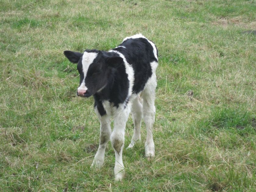
Hickling cows
Hickling cows

Hickling from the Standards trigpoint
Hickling from the Standards trigpoint
")
Hickling from the Church Tower (south)
Hickling from the Church Tower (south)

Hickling Basin & The Plough Inn
Hickling Basin & The Plough Inn

Hickling in the snow
Hickling in the snow

The original Domesday Book Village Map
The original Domesday Book Village Map
Prev
Next
If you have any images that you would like adding to the Village Tour photo gallery – please use the contact page.